Jun 21, 2010

Haghpat Monastery, Armenia, 18 June 2010

Haghpat monastery was founded, like Sanahin Monastery, by Queen Khosrovanush around 1000.

Haghpat was major literary center, and maintained rich feudal lands until the monastery properties were confiscated by the Russian Empire in the 19th c.

Haghpat and Sanahin Monastery are included in the UNESCO World Heritage List based on the following arguments: These two Byzantine monasteries in the Tumanian region from the period of prosperity during the Kiurikian dynasty (10th to 13th century) were important centres of learning. Sanahin was renowned for its school of illuminators and calligraphers. The two monastic complexes represent the highest flowering of Armenian religious architecture, whose unique style developed from a blending of elements of Byzantine ecclesiastical architecture and the traditional vernacular architecture of the Caucasian region.


Sourb Nshan (Holy Sign of the Cross) church


The 1245 bell-tower in Haghpat. Its first storey is cross-shaped in the plan, and the second one rectangular, with the angles cut off.


Some details from the bell-tower


Munumental sculptural group of Kings Kyurike and Smbat in the severe and majestic eastern facade of Amenaprkich church. The first high-relief representation of human figures with a model of a church in Armenia.


View over the landscape from the monastry

Sanahin Monastery, Armenia, 18 June 2010


Amenaprkich (Holy Redeemer) church


Monastery interior


Entrance to the main church with two Khachkars (cross-stones)

Haghpat and Sanahin Monastery is situated in the Debed canyon close to Alaverdi, the last of major industrial towns with their ruin of enormous soviet industrial complexes, situated on the road along the Debed River from Yerevan to Tbilisi. We decided to visit both monasteries on our way from Yerevan back to Tbilisi.

The exact date of the foundation of Sanahin and Haghpat is unknown, but is estimated to before year 1000.

In the monasteries, humanitarian sciences and medicine were studied, scientific treatises written and paintings, most miniatures, created.

Built in the monasteries over three centuries were more than 20 various churches and chapels, bell-towers, the building of the Academy, book depositories, refectories, galleries, bridges and other monumental structures, to say nothing of numerous dwelling and service premises.

The main monastery buildings are grouped around their chief temples, forming integral architectural organisms.

Sanahin and Haghpat complexes have in common are not only the compositional features of various structures. The architectural details and decoration of the monuments, which belong to the same epoch, have much in common and are even exactly alike in some cases, which give ground to presume that they were created by craftsmen of the same school.

The name Sanahin literally translates from Armenian as "this one is older than that one", presumably representing a claim to having an older monastery than the neighbouring Haghpat Monastery. The two villages and their monasteries are similar in many ways, and lie in plain view of each other on a dissected plateau formation, separated by a deep "crack" formed by a small river tributary to the Debed river.

Back from Shatili, 13 June 2010


We started the day with a hike along a small river. Dima participated.


A difficult part of the road where some inspection was needed before passing


Teamwork in clearing the river bed of a tributary crossing the road before we pass it:
- Vlado is working.
- Dima is giving advice.
- I am watching and making photos.


A herd of sheep


An impressive defensive tower.


The sceneries, when we were driving up to the mountain pass and down on the other side, were fantastic.

It was far easier to get back from Shatili to Tbilisi, driving in the daylight. Here and there, especially when a tributary was crossing the road, we had to stop and inspect the road, move a couple of the biggest stones.

The sceneries, when we were driving up to the mountain pass and down on the other side, were fantastic.

Jun 20, 2010

From Shatili to Mutso, 12 June 2010


Shatili is actually a unique complex of medieval-to-early modern fortresses and fortified dwellings of stone and mortar which functioned both as a residential area and a fortress. The fortress consists of the terraced structures dominated by flat-roofed dwellings and some 60 towers which cluster together to create a single chain of fortifications.


The population of Shatili, along with that of most of the Khevsureti, was resettled under the pressure from the Soviet authorities to the plains in the early 1950s. In the 1960s, the exotic landscape of the empty village was used as a setting for a series of Georgian films about the past life of the highlanders.


Shatili is situated in the part of Caucasus called Khevsureti, near the border with Chechnya. It is located in the deep Arghuni gorge at approximate 1,400 meters


From the road we spotted a cluster of very small stone houses. We went to explore them further and found out that there very no entrance but inside a lot human skulls and bones.


Our landlady from Shatili explained us that the dead from a smallpox epidemic was buried here. When people from the village realised they were infected they went to this place to die or recover, not to infect the ones left in the village. One of from her family was also buried here.


The River shifted between section with torrential flow and section with more quit flow


There were a few families living alongside the road


Vlado and “our” dog are taking a rest while waiting for me


The towers of Mutso


The Mutso fortress


View from the Mutso fortress


There very many butterflies on the road collecting minerals


It was a hot day so “our” dog tog a bath in the river now and then to cool down

The next day was nice and sunny, and we went down the jeep track in direction Chechnya until we meet a border post. From there the track continued up a tributary to another old fortified settlement, Mutso.

It was a 13 kilometre nice walk to Mutso in the beautiful landscape.

The Mutso village, almost completely abandoned more than a century ago, is a home to approximately 30 medieval fortified dwelling units arranged on vertical terraces above the Mutso-Ardoti gorge, four combat towers and ruins of several old structures and buildings.

A legend has it that the villagers worshiped the Broliskalo Icon of Archangel. They were renowned as fighters and hunters, and considered themselves permanent members of the army of the sacred flags and guardians of fabulous treasury donated to the Icon over the centuries. The legends say the treasury that is still kept in the high mountains around Mutso waiting for the chosen one to come.

A friendly dog kept us with company the whole way.

When we arrived back to Shatili, my legs were rather tired.

To Shatili, 11 June 2010


On our way to along the Aragvi River to the mountain pass


Vlado and Dima is inspecting one of the difficult sections of the road down from the mountain pass to Shatili to see if we can drive through


The few families left in Shatili is living next to the original castle complex. We were staying in the house to the left


The man in the house, the local doctor, was a dedicated hunter


Saturday we were served had bear (small young bear) for dinner. The remains of the young bear can be seen in the fridge


When we woke up next morning we experienced a flat tire. We had only a "emergency wheel" as reserve, so we were in trouble


Fortunately another group of tourists were in the village. The had hired a 4WD with an experienced driver, who had the necessary equipment with him, and he fixed our tire without any problems


The couple in our house had two boys. Here are the future bear hunters

Shatili is another fantastic village on the north slope of Caucasus. Actually we did not know much about Shatili, or the road to Shatili when we planned our trip. We decided to start our trip Friday after work so we had at least one whole day in Shatili.

This was a very unwise decision, we learned. We had estimated that it would take 3½ hours of driving to get to Shatili, but after 3½ hours, we had not yet crossed the mountain pass (2720 meter). The road (or rather jeep track) was very bad and not at all suited for the old WV golf we were driving in. I was later informed that we probably the very first driving to Shatili in a car that were not 4WD – may not be true, but it was also what I felt after 2 hours driving on the jeep track with deep gorges in total darkness without meeting one single other car.

But to our relief we finally reached Shatili, and also succeeded to find a place to stay, at one of the few families left in the village.

The man in the house, the local doctor, was an eager hunter, and next day we had bear (small young bear) for dinner.

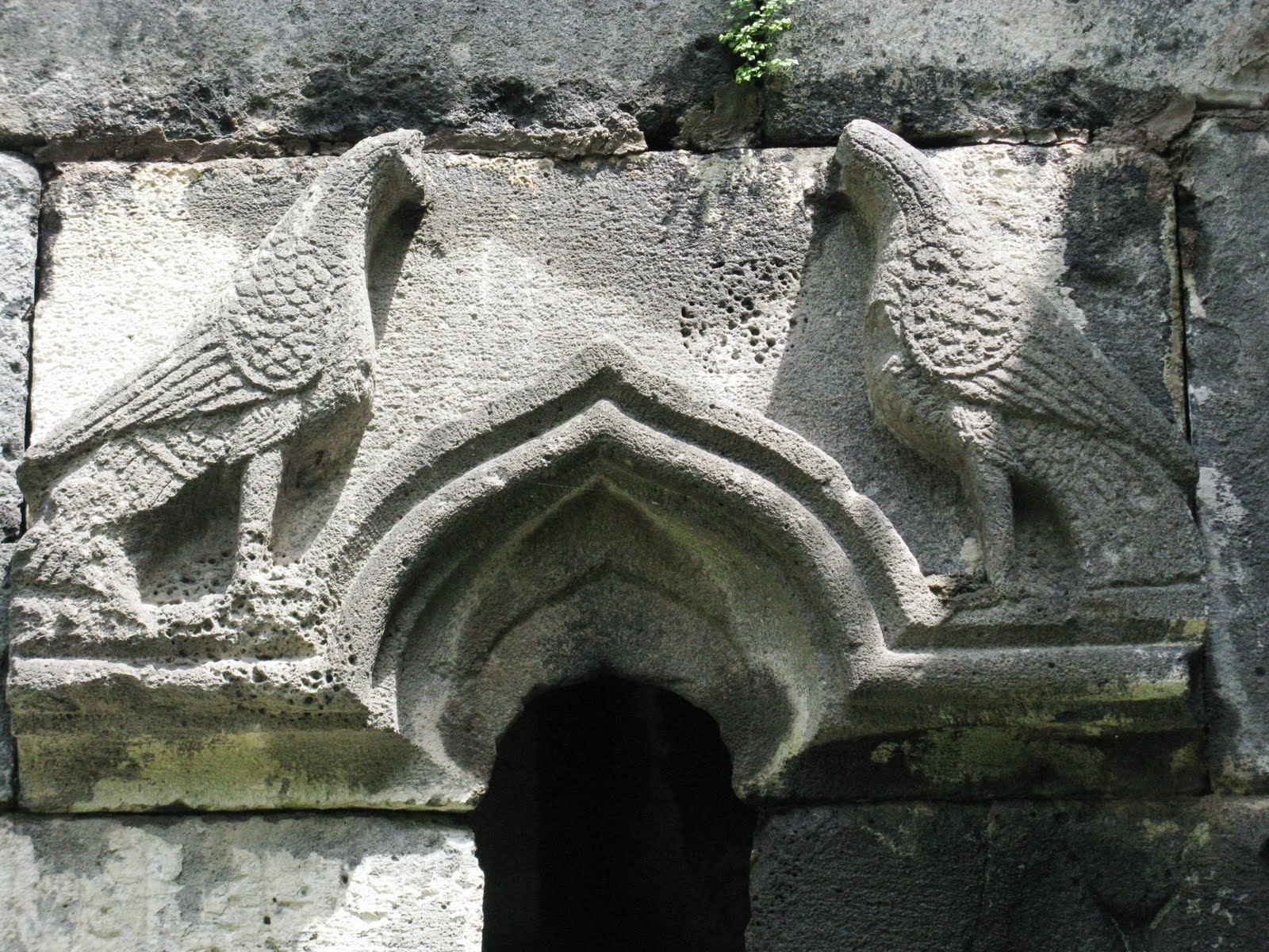
Shatili is situated in the part of Caucasus called Khevsureti, near the border with Chechnya. Located in the deep Arghuni gorge at approximate 1,400 meters, the village is actually a unique complex of medieval-to-early modern fortresses and fortified dwellings of stone and mortar which functioned both as a residential area and a fortress. The fortress consists of the terraced structures dominated by flat-roofed dwellings and some 60 towers which cluster together to create a single chain of fortifications.

The population of Shatili, along with that of most of the Khevsureti, was resettled under the pressure from the Soviet authorities to the plains in the early 1950s. In the 1960s, the exotic landscape of the empty village was used as a setting for a series of Georgian films about the past life of the highlanders.

Shatili is still inhabited by a dozen or so families, but is inaccessible by road during wintertime. We were told that the road had opened 2 weeks before we arrived.

Jun 10, 2010

Lagodekhi, Machi Castle, Sunday 6 June 2010


On the other side of the river is Azerbaijan.


Entrance to the castle ruins


The church of the castle was still standing


On our way back - also for this trail we had hired a guide, and I do not think that we could find our way without him.


The 4½ kilometre trail to the Machi Castle stretches along the Matsimchai River which is the border to Azerbaijan. After a step walk down to a tributary my legs, who suffered from the two hikes to the waterfalls Saturday, told me that it was time for a rest. Fortunately the caste was just uphill from the tributary to the Matsimchai River, so I mobilised my last resources and managed to reach the castle ruins, and also back again after some rest at the ruins.

Lagodekhi, Big Waterfall - Lagodekhi Waterfall, Saturday 5 June 2010


The waterfall was very impressive and worth the difficult walk.


Some youngsters from the nearby village had organised a schaslick party, and we were invited.


Our guide did not think that I was able to manage the walk to the second waterfall I the nature park, so we decided to do it on our own.

The 7 kilometre route starts followed the gorge of Ninoskhevi River, and the waterfall was very impressive.

On our way up we meet a group of young people from the local village, Zemo Gurgeniani, preparing for a schaslick party. On our way down we were invited to join them in way that we could not refuse. So we got some schaslick, bread and a lot of white wine.

Maybe too much wine because on our way back we missed the part of the trail which lead to a bridge, and we had to wade over the river, and took the opportunity clean us from the sweat and dust from the very hot and exhausting 24 kilometres of walking.